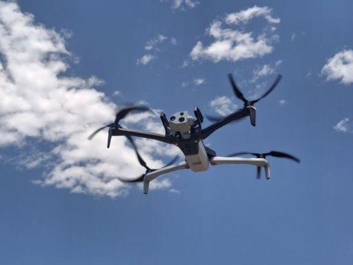
Back when I first watched a land survey crew work a site, it felt like time moved in thick mud. Tripods. Tape measures. Guys standing around waiting for one person to finish a reading. It worked, sure, but it burned hours and money. Surveying Drones didn’t come along to be flashy toys. They showed up because the old way just wasn’t cutting it anymore. When you can send a small flying camera over a rough patch of ground and get usable data in minutes, the math changes. Fast. Aerial Mapping used to be something you saw in big-budget projects only. Now it’s just… Tuesday. And the people on site don’t have to climb sketchy slopes or wade through junk to get basic measurements. That alone makes the shift worth it.
How Surveying Drones Actually Capture the Ground
Here’s the part most people miss. Surveying Drones aren’t just flying around snapping pretty photos. They’re doing drone mapping with intent. The flight paths are planned. The overlap matters. The sensors matter. You stitch those images together and suddenly you’ve got a clean surface model you can measure from. Drones for Mapping changed how fast teams can check elevations, volumes, even drainage patterns. You don’t have to guess. You can see it. And yeah, sometimes the first pass isn’t perfect. Wind messes with you. Light changes. But the second run? Still faster than sending a crew back out for another full day.
Why Aerial Mapping Isn’t Just for Big Companies
There’s this idea that Aerial Mapping is only for massive construction firms with money to burn. That’s old thinking. Small contractors, landowners, even local planners are using Surveying Drones now. You can map a few acres without hiring a full survey team and waiting weeks. That doesn’t mean surveyors are obsolete. Far from it. It means their time is better spent checking data, interpreting it, making calls that matter. Drone mapping gives them better inputs. Cleaner inputs. The kind you don’t have to squint at. And when deadlines are tight, which they always are, that speed buys you breathing room.
Where Security Drones Enter the Picture
Now let’s talk about Security Drones, because this is where things get interesting. Surveying Drones and Security Drones aren’t the same tool, but they live in the same world. A site that’s being mapped is often a site that needs watching. Construction zones, remote land plots, infrastructure corridors. You can map in the morning and run patrols at night with similar hardware. Security Drones aren’t about sci-fi stuff. They’re eyes in the air. Quiet ones. They cover blind spots and give you context when something feels off. It’s not replacing guards. It’s backing them up when they can’t be everywhere at once.
Real-World Use Cases That Don’t Make the Brochure
I’ve seen Drones for Mapping used on muddy farmland after a storm, just to figure out what washed out. No glossy demo reel. Just a farmer trying to save his crop. I’ve seen drone mapping on half-finished housing projects where nobody knew exactly how much fill was missing. The Surveying Drones didn’t care about the mess. They just did the job. And Security Drones? Same deal. A warehouse manager used one to track late-night trespassers. Not dramatic. Just practical. These tools live in the boring middle of real work. That’s where they matter most.
The Learning Curve Is Real, But It’s Not a Wall
Nobody picks up Surveying Drones and becomes a mapping wizard overnight. The software has quirks. The data takes practice to read. You’ll mess up a flight path or two. It happens. But the curve isn’t a cliff. Most teams figure out the basics in weeks, not years. Aerial Mapping platforms are getting friendlier, even if they still glitch on bad days. Same with Security Drones. You learn where to fly, when not to fly, and how to keep people comfortable with a drone buzzing overhead. Trust matters. You don’t get that by acting like it’s all perfect tech.
Limits, Regulations, and the Stuff People Ignore
Surveying Drones come with rules. Airspace. Permissions. Weather windows that don’t care about your schedule. You can’t just launch anywhere and hope for the best. Security Drones especially draw attention, and not all of it good. Privacy is a real concern. So is safety. The tech is powerful, but it’s not magic. Batteries die. Sensors glitch. Sometimes your drone mapping data needs a ground check because the shadows tricked the model. That’s normal. The mistake is pretending these tools replace judgment. They don’t. They support it. Big difference.
Conclusion: Surveying Drones Are Tools, Not Miracles
Surveying Drones changed the pace of work. That’s the truth of it. They made Aerial Mapping and Drones for Mapping accessible to more people, and they nudged Security Drones into everyday operations instead of niche use. But they’re still tools. Good ones. Flawed ones. They need planning, a little patience, and someone who knows when to trust the data and when to double-check with boots on the ground. If you treat them like silver bullets, you’ll be disappointed. If you treat them like hard-working gear that makes your job lighter, you’ll wonder how you ever worked without them.
Join our community to interact with posts!